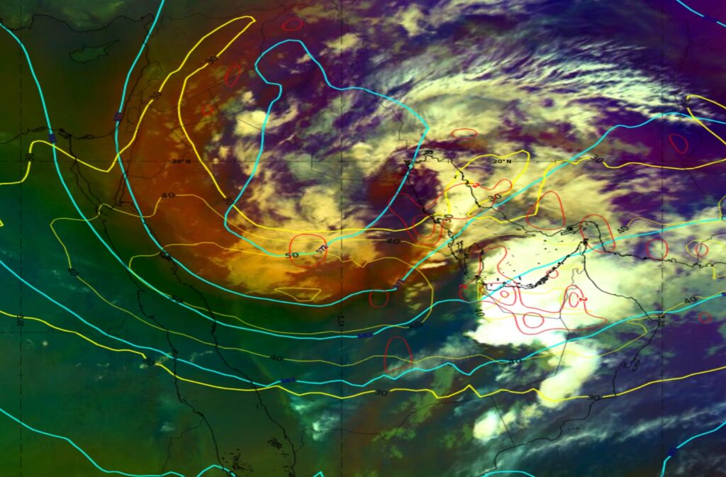
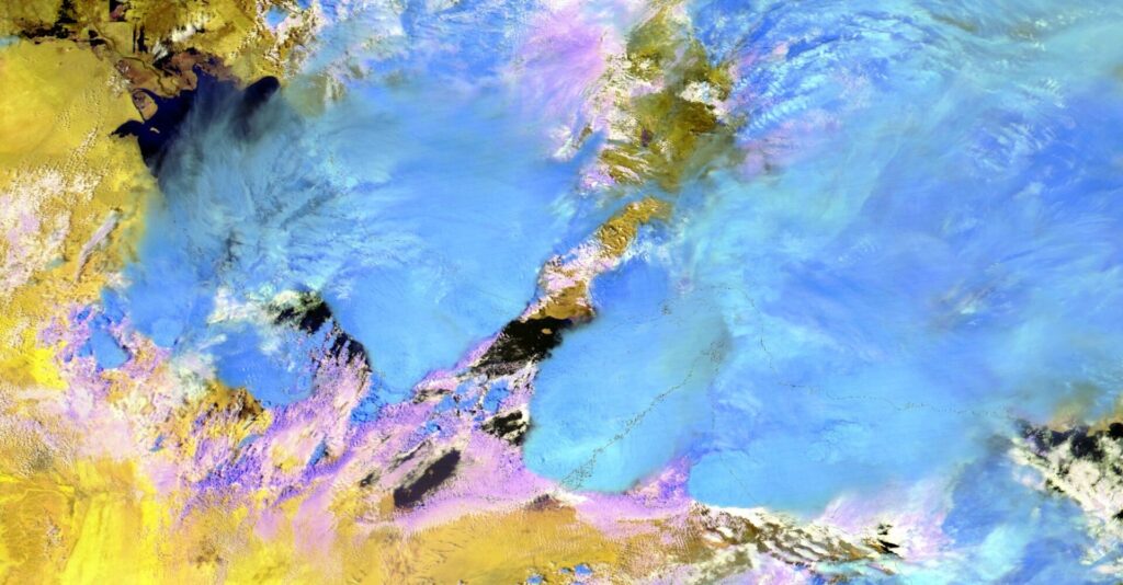
Late on 14 April, a deepening large scale trough moved from the Mediterranean into southern Persian Gulf. Above United Arab Emirates and Oman, large scale flow veered from westerly to southwesterly, with strengthening of the upper-level jet stream. Figure 1 shows the aforementioned synoptic situation on 15 April 2024, 18:00 UTC. The Airmass RGB has been overlaid with ECMWF data: 500hPa geopotential (cyan), 300hPa isotachs (yellow) and 300hPa cyclonic vorticity advection (red). The scene is dominated by a large scale upper level low paired with a westerly-southwesterly jet stream and positive cyclonic vorticity advection. This caused further formation and deepening of the surface low pressure system; resulting in thermal and dynamic conditions that were very conducive for severe thunderstorm development in the period 14-17 April.
The Dust RGB is always useful for assessing low level moisture in a clear atmosphere, which was a case at the very beginning of the loop, across much of southern Saudi Arabia, UAE and Oman. Different shades of deep blue colour can be noted, which suggest high humidity in the low level atmosphere, which is one of the key ingredients for thunderstorm formation. As the loop progresses several instances of strong vertically developed cloudiness can be seen impacting the area. Strong thunderstorms also feature intensive outflow boundaries, created at the leading edge of the storm front. However, these are typically more obvious in visible channels with higher spatial resolution. Still, the storms developing on 16 April produce such strong outflows that they can be seen in Dust RGB, as significantly cooler air spreading to the south from multiple storms. Lastly, since the region is mostly desert, a lot of dust had been lifted across Saudi Arabia during the period, which showed in the typical magenta colour.
The same outflow boundaries that can be seen in Dust RGB, are visible in the High-Resolution Visible composite in Figure 2, as bow-like thin cloud formations close to the border of UAE and Saudi Arabia. Numerous storm tops further east is also displaying overshooting tops, another sign of storm severity, seen as small protuberances, which create shades away from the sun (local time late afternoon suggesting that sun shines from the left-hand side).
Figure 3 shows the same product, HRV composite, from the same region earlier that day. A very intensive storm can be seen close to the Abu Dhabi area in UAE. It is interesting to note a significant shadow being projected towards the west from the storm’s core (note in the early morning sun shines from the right hand side in the image). Another symbol of storm severity is an above anvil cirrus plume, which can be seen at the cloud top as a very elongated V-shaped feature, stretching from near the storm’s core all the way into Iran. Looking downstream, along the left side of this V shape, there are gravity waves, which are a consequence of strong interaction between the updraft and the tropopause.
The question of cloud particle phase and size is best addressed with the Cloud Phase RGB (Figure 4), which will be a standard RGB with MTG FCI. It very efficiently distinguished between small ice crystals (light blue), large ice crystals (dark blue), small water particles (white), and big water particles (magenta/violet). Small ice crystals. when seen at top of the storms, require additional inspection, especially in the region of overshooting tops, when they suggest the storm’s severity is high.
The Severe Convection RGB is a standard RGB in the MSG collection of RGBs, and its main use is to identify storm top areas with small ice which suggest (as previously noted) strong updrafts in thunderstorms. Here, small ice crystals can be seen as yellow. The main limitation of the Cloud Phase RGB, as well as the Severe Convection RGB, is that they are only available during the daytime, because cloud phase and particle size detection rely heavily on channels in the VIS and NIR spectrum.
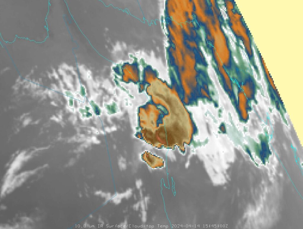
A storm top is also closely monitored for specific shapes in its thermal field. In the colour enhanced IR 10.8 window channel, a ring or U/V shaped pattern is almost always visible in the strongest storms. In Figure 5 such a case can be seen close to the Arabian Sea coast of Oman, where two strong storms display circular shapes of low temperature and central area, which is warmer.
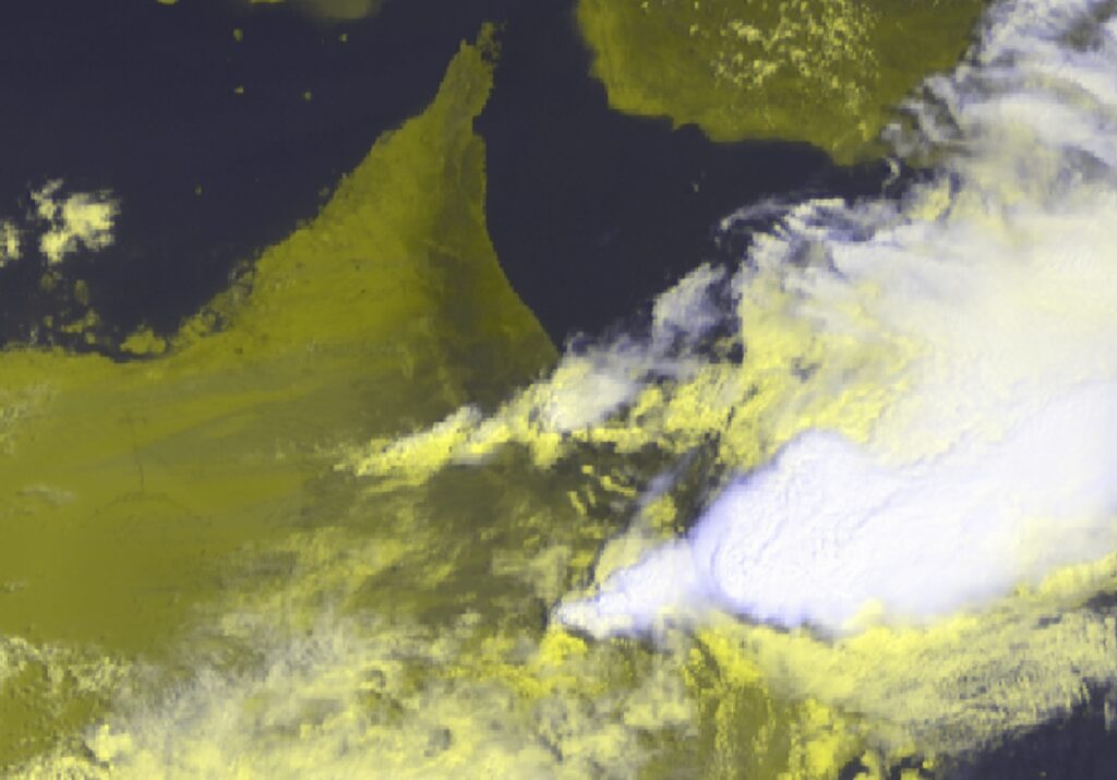
A closer look at one of the storms above Oman on 14 April can be seen in the HRV RGB (Figure 6). A strong multi-cell cluster, with prominent overshooting tops and U/V shaped storm top, is a central feature in this image.
A increased zoom in to the storm’s core is shown in Figure 7. On top of the HRV RGB there is a a semi-transparent overlay of IR10.9 from Landsat-9. Thanks to the 100m resolution and colour enhancement the finest details of the storm top topography can be seen. It is possible to locate a prominent overshooting top, followed by an above anvil cirrus plume (elongated green veil stretching to the right from the overshooting top), suggesting the storm’s severity.
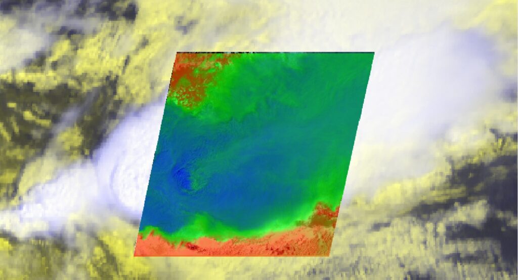
Figure 8 shows the difference between pre- and post-event using the Natural Colour RGB. The first image is from 17 January 2024, without floods, and the second image is from 17 April just after the event. As clouds move and produce heavy rainfall, they leave their marks on earth. Looking from above these can appear as lines, known as called downpour tracks. In the Natural Colour RGB, they show as a slightly darker shade of brown than for the typical brown for sand. Plenty of downpour tracks can be seen in the region of the border between UAE and Saudi Arabia. Also, significant increase in water-like surfaces (slightly darker brown shade) in coastal areas of UAE can be noted (flooded, or recently flooded, areas).
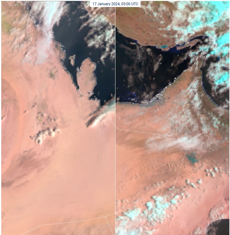
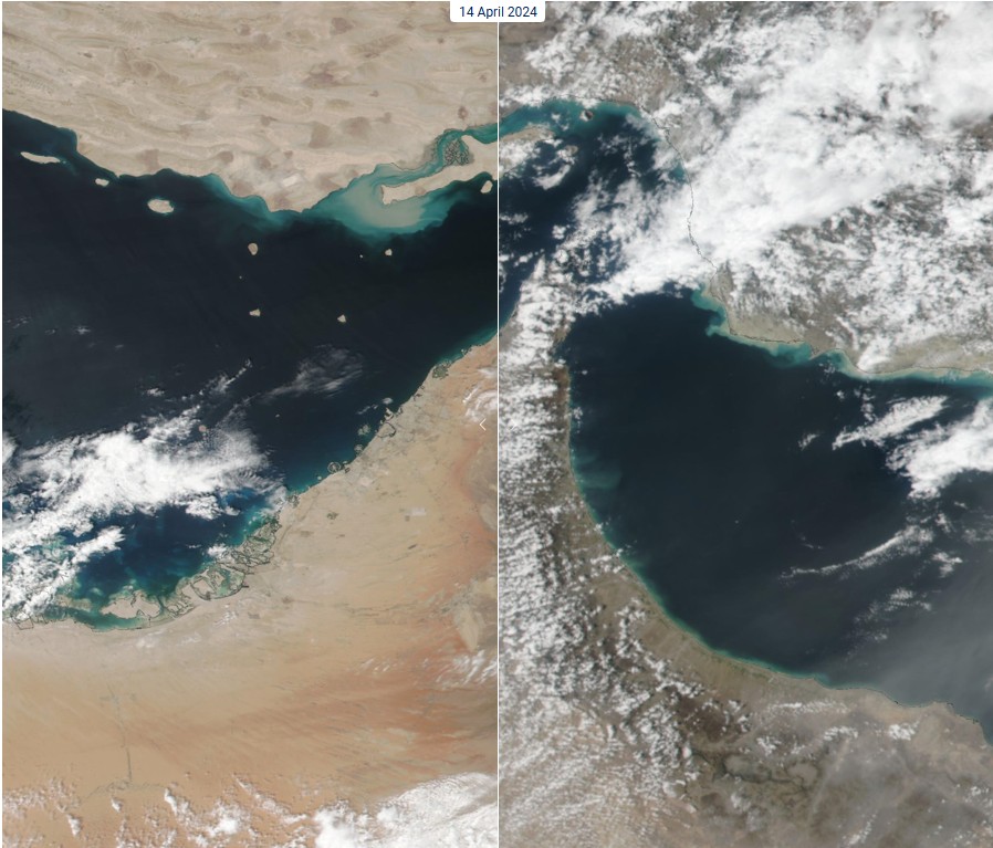
Figure 9 shows increased water turbidity which is depicted as various shades of blue and brown just off the coasts of the region. A significant difference can be noted between the first image (14 April) and the second image (17 April). While the coastal areas seem quite dark blue-black before event, there is a lot of brown in the mix in the latter image.