What Are Westerly Disturbances?
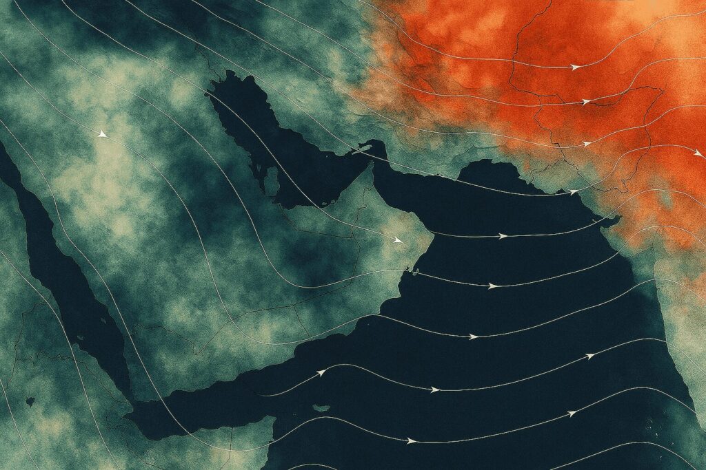
Westerly disturbances are low-pressure weather systems that form high up in the atmosphere over the Mediterranean Sea. These systems are called “westerly” because they move from west to east, carried by winds in the upper atmosphere. As they travel across the region, they bring changes in weather, including rainfall and sometimes snowfall to parts of the Arabian Peninsula, Iran, Pakistan, and India.
Though the term may sound unfamiliar to many, it plays an important role in shaping the winter climate in several countries, including Oman, especially in the northern parts.
How Do Westerly Disturbances Occur?
These systems begin when a low-pressure area develops in the upper air layers over the Mediterranean region. As it moves eastward, it often carries with it a mass of cold air from the upper levels of the atmosphere. When this cold air meets the relatively warmer and moisture-laden air in lower levels, such as over the Arabian Sea or the Arabian Peninsula, it leads to the formation of clouds and, in some cases, intense weather activity.
The strength and behavior of a westerly disturbance depend on several factors:
- The depth of the trough, which refers to how low the pressure dips in the atmosphere.
- The amount of moisture available in the lower and middle levels of the atmosphere.
- The presence of cold air masses in the upper atmosphere.
- The surface temperature in the region it passes over.
Cases of Westerly Disturbances in Oman
Oman has experienced several notable weather events caused by westerly disturbances, especially during the cooler months between November and March. Here are some examples:
- End of November 2015: A significant westerly disturbance affected northern Oman, marked by a closed lowpressure system. This type of system often leads to unstable weather conditions and brought scattered rainfall across some areas.
- 26–27 December 2015: Another westerly disturbance passed over Oman, characterized by a deep trough, although it was accompanied by low humidity. Despite limited moisture, it caused light to moderate rain in several northern regions. Notably, Khasab recorded 8.8 mm of rainfall during this event.
- January 2022: A strong westerly disturbance led to widespread rainfall and thunderstorms in northern parts of the country, resulting in temporary road closures and flash floods in some wadis.
Effects of Westerly Disturbances
The passing of a westerly disturbance brings noticeable changes in weather. Depending on its strength, it can cause:
- Deep convection and thunderstorms, resulting in dark clouds and heavy downpours.
- Lightning and thunder.
- Occasional hailstorms, especially if cold air aloft meets warm air at the surface.
- Strong downdrafts, where cool air rapidly descends, often leading to sudden gusts of wind.
- The risk of flash floods in wadis and low-lying areas due to intense, short-duration rainfall.
How to Stay Safe During a Westerly Disturbance
Since these weather events can arrive suddenly and sometimes bring severe conditions, it’s important for the public to stay prepared:
- Follow official weather updates from the Oman Meteorology Department via social media, radio, or their official app.
- Avoid venturing into wadis during rainfall, as flash floods can occur without warning.
- Drive cautiously during thunderstorms and hailstorms, as roads may become slippery or temporarily flooded.
- Keep an emergency kit at home and in your vehicle during the rainy season.
- If lightning occurs, it’s best to stay indoors and avoid open spaces and tall, isolated structures.
Conclusion
Westerly disturbances may be a natural part of our region’s climate system, but their effects can vary from beneficial rainfall to severe thunderstorms and flash floods. By understanding how these systems work and staying alert during their passage, we can better appreciate Oman’s dynamic winter weather while keeping ourselves and our communities safe.