Tropical cyclones in the Arabian Sea are becoming stronger and more frequent during the pre-monsoon (April–June) and post-monsoon (October–December) periods. Rising sea-surface temperatures, along with changing wind and humidity patterns, drive this intensification. Most storms form in these peak periods, though occasional cyclones can develop outside them, usually weaker.
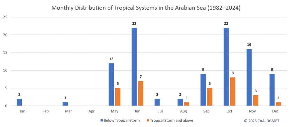
Cyclones affecting Arabian Sea follow two main peaks each year:
- First peak: May–June
- Second peak: October–November
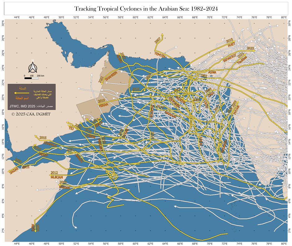
The below map highlights only the systems that reached tropical storm intensity and above, emphasizing the area’s most frequently affected by stronger cyclones.
Strongest and Longest-Lasting Cyclones
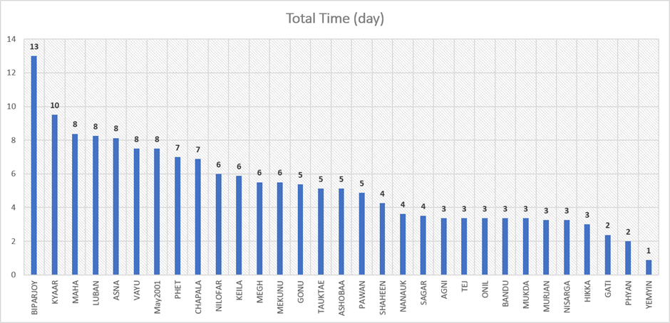
Strongest storms:
- KYAAR – 130 kt, 10 days
- GONU – 127 kt, 5 days
- CHAPALA – 115 kt, 7 days
Longest-lasting cyclones:
- BIPARJOY – 13 days, Category 2
- KYAAR – 10 days, Category 4
- MAHA – 8 days, Category 3
Cyclones in the Arabian Sea move at an average speed of ~14 km/h, though some are slower, like BIPARJOY (8 km/h), and some faster, like HIKKA (20 km/h). The longest path was recorded by MAHA, covering nearly 3,000 km over 8 days.
This article reviews and analyzes tropical cyclone data obtained from the official datasets of the India Meteorological Department (IMD) and the Joint Typhoon Warning Center (JTWC).