
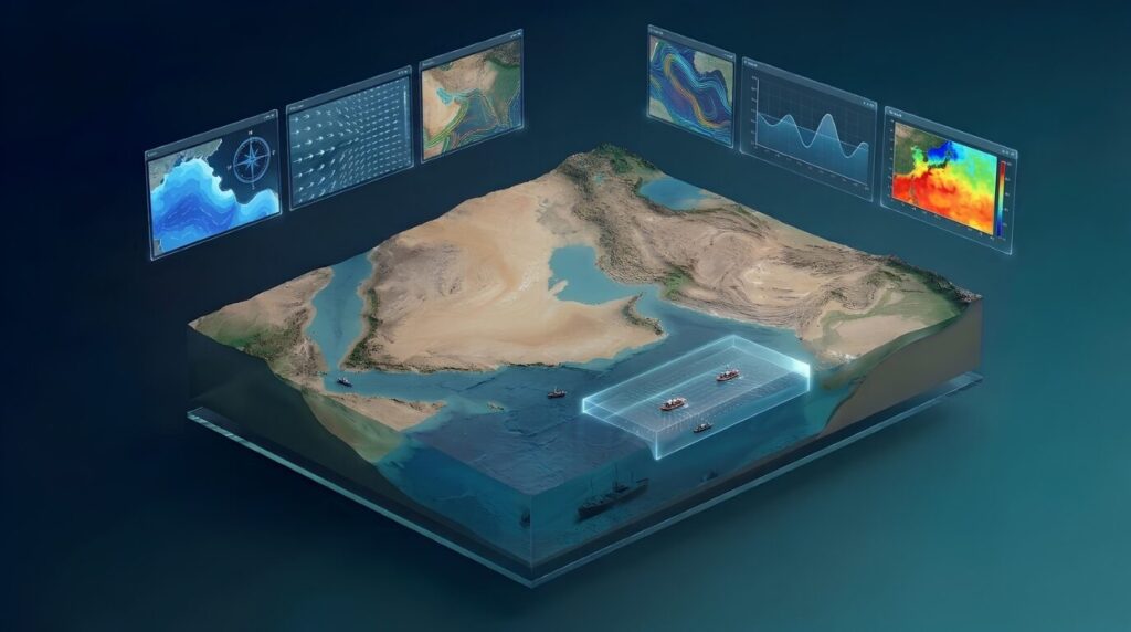
Meteorological and oceanographic sciences are advancing rapidly, driven by numerical forecasting, which has become an essential tool for understanding natural phenomena and predicting their evolution. This technology relies on high-performance computers to solve mathematical equations that simulate physical processes in the atmosphere, seas, and oceans, using a wide range of data from satellites, observation stations, buoys, and radars. For more details, please refer to this article “Numerical Prediction“
Originally focused mainly on weather prediction, numerical forecasting is now also widely used in marine applications. Coupled atmospheric and ocean models provide forecast fields that support search and rescue operations, oil-spill tracking, and operational decision-making.
What Do Marine Numerical Forecasts Provide?
Marine numerical models provide important information about sea conditions and movement. Their key outputs include:
- Forecast wave height and direction.
- Speed and direction of ocean currents.
- Water movement in coastal areas and the open sea.
- Sea level and tides.
- Sea surface temperature.
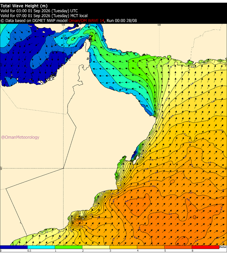
The figure shows the forecast wave height and wind movement at 07:00 AM on 1 September 2026.
These outputs, together with weather-model forecasts, are used as essential input data for other specialized models that simulate the movement of floating objects and materials on the sea surface, such as missing persons, vessels, or oil spills.
Tracking the Movement of Missing Persons at Sea
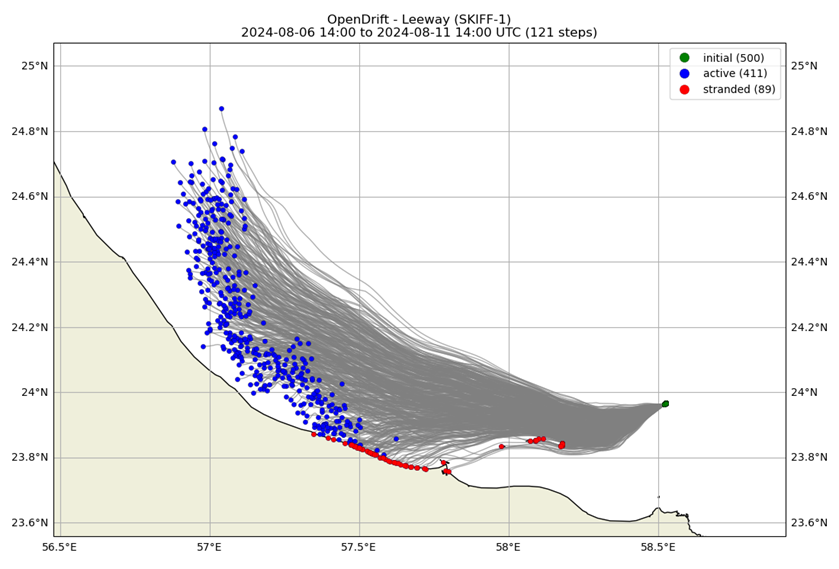
Simulation of potential drift trajectories of a missing object at sea using the open-source OpenDrift model, initialized within a 100-metre-diameter search area.
A missing person or vessel can drift from its last known position due to the combined effects of ocean currents, waves, and wind. Therefore, the last known position alone may not represent its current location, especially as time increases.
Floating-object drift models use atmospheric and marine forecast fields to simulate possible trajectories and estimate the areas where the object is most likely to be located. The results can support search and rescue teams by identifying priority search areas, reducing the search domain, and improving the deployment of marine and aerial resources.
These forecasts provide an estimate of the most probable drift area and do not represent a confirmed location. They complement field observations and operational search activities.
Oil-Spill Tracking and Marine Pollution Control
Following an oil spill, the slick is transported and dispersed by wind, ocean currents, and waves. Physical processes such as evaporation, dispersion, and mixing with seawater also affect its evolution and spread, potentially resulting in impacts on coastlines and sensitive marine areas.
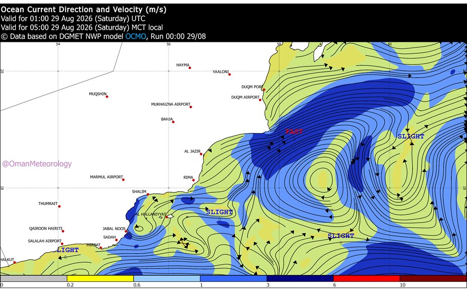
The figure shows the forecast movement of ocean currents at 05:00 AM on 28 August 2026.
Predicting the movement of an oil spill relies on the integration of several numerical models working together. Atmospheric models provide forecasts of wind and weather conditions, while marine models simulate wave and ocean-current movement. Marine pollutant dispersion models then use these outputs to simulate the movement of the oil slick and predict its trajectory and spread over the following hours and days.
These models provide important information to the relevant authorities, including:
- The expected direction of oil-spill movement.
- Areas expected to be affected.
- The estimated time for the oil to reach the coastline.
- Suitable locations for response operations.
This information supports appropriate response measures, such as deploying floating containment booms, directing response teams, protecting coastal areas and critical infrastructure, and reducing the environmental and economic impacts of marine pollution.
The quality of these forecasts depends on the accuracy of all components of the system, starting with the quality of the input data, followed by the accuracy of atmospheric and marine models, and finally the specialized pollutant-dispersion models. Therefore, the results are continuously updated as new data become available to improve forecast accuracy and reduce uncertainty.