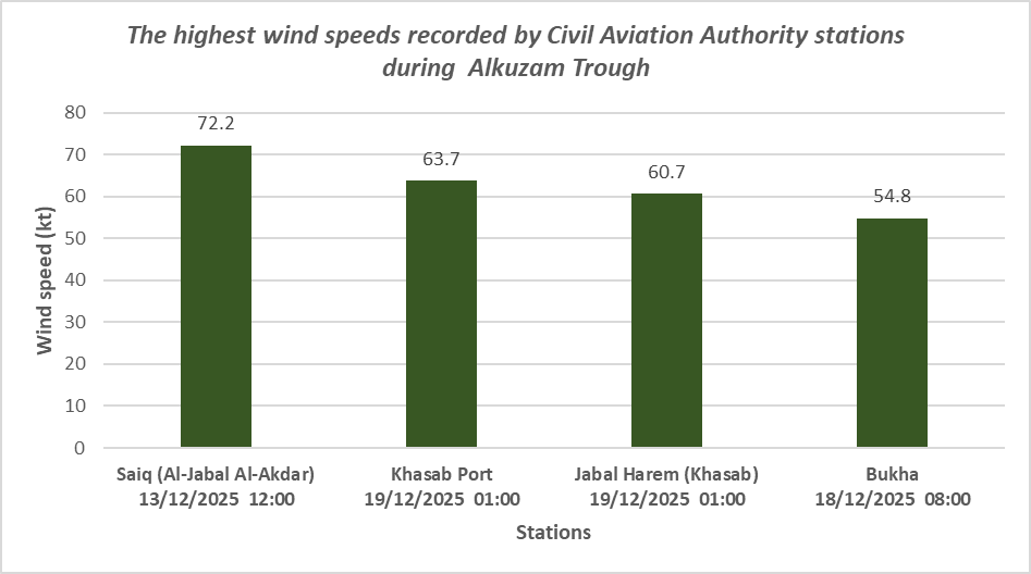
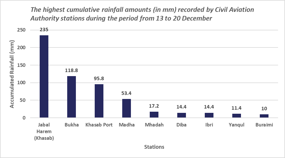
Weather maps began to show forecasts indicating that the atmosphere of the Sultanate of Oman would be affected by a western low-pressure trough in mid-December 2025. The Multi Hazards Warning Center issued Report No. 1 on 13 December 2025, confirming that the Sultanate would be influenced by the atmospheric trough during the period from 13 to 20 December. This system caused rainfall of varying intensity and, at times, active winds. Thirty stations across the country recorded rainfall ranging from light and moderate to heavy, while ten stations recorded active wind gusts exceeding 40 knots. The graph 1 shows four stations that recorded the highest wind speeds.
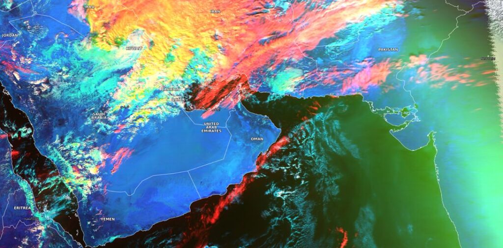
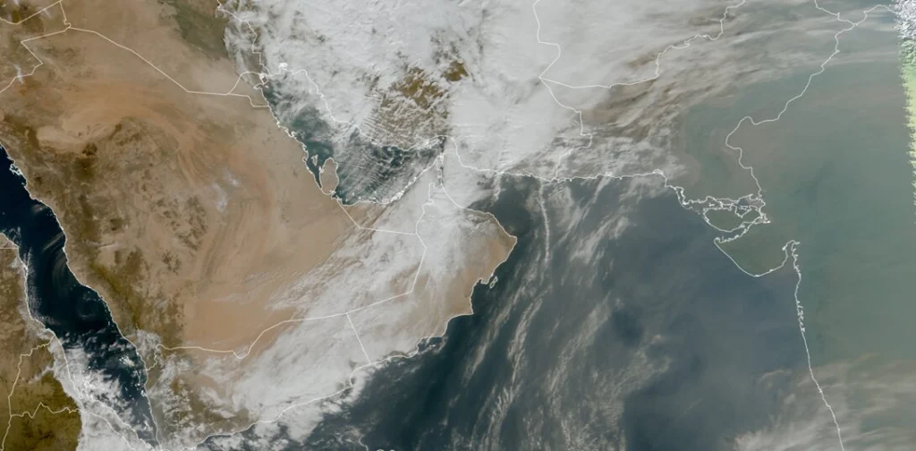
Using the Cloud Type product in Figure 2, convective clouds (dense and thick) appear in shades of yellow and red.
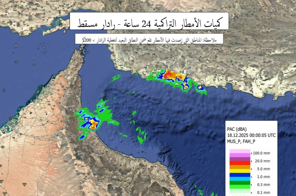
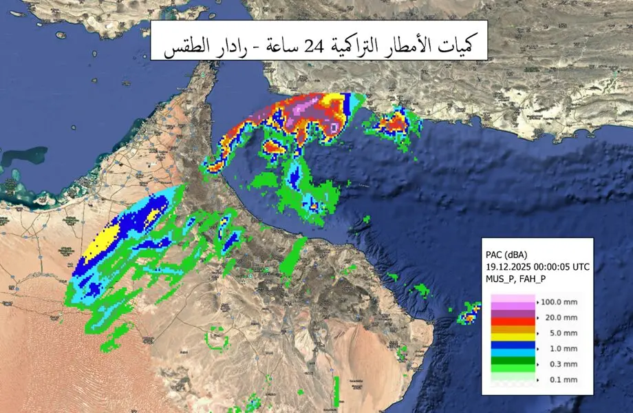
Damages reported due to Heavy rains and Wadis:
Continuous heavy rainfall and wadi flows caused some damage to parts of roads in several areas of Musandam Governorate. Students were also evacuated from one school in the governorate due to rising water levels in nearby wadis.

References:
- DGMET, CAA, OMAN
- @CDAA_OMAN